Drive section
Euclid, Mentor, and Madison
Eastern Greater Cleveland Route 20 segment for a direct crossing, one Lake Erie detour, James A. Garfield history, or a Madison wine-country handoff.
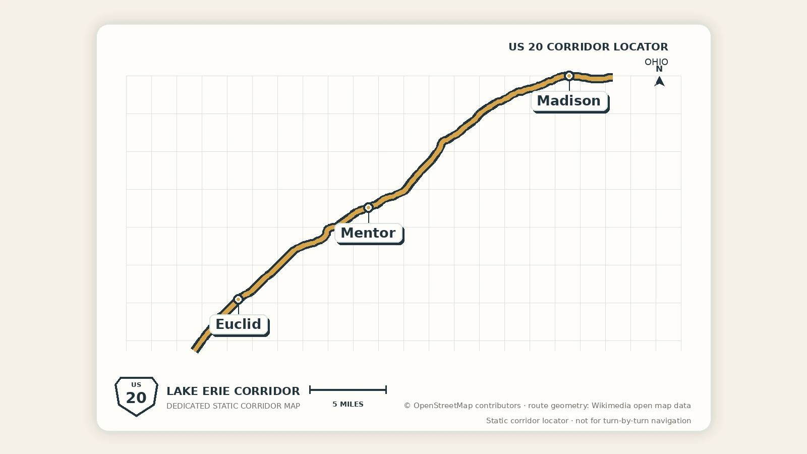
Euclid, Mentor, and Madison
This section carries Route 20 out of Cleveland and toward Geneva. The most useful plan is selective: Euclid offers a short lakefront detour, Mentor carries the strongest history and nature choices, and Madison provides the smaller village, park, or wine-country handoff.
Segment map
Segment map
This Google map keeps the geography literal. The compact rows below surface optional off-route trips and add-on stops without taking over the segment.
Quick orientation
Loading current segment layer signals…
These compact rows are optional off-route trips and add-on stops, with the full corridor layer map still available when you want the broader read.
Choose the version of the drive
Direct crossing
Leave Cleveland, keep Euclid to services or a brief pause, make James A. Garfield National Historic Site the principal stop when its schedule fits, and continue through Madison toward Geneva. This version stays closest to the Route 20 spine and avoids stacking north-of-route lakefront detours.
Lakefront crossing
Choose one of Sims Park, Headlands Beach, Mentor Marsh, or Mentor Lagoons. All require some movement away from the direct U.S. 20 line, and each can expand with parking, walking, summer congestion, weather, or shoreline conditions. One deliberate lakefront choice is usually more satisfying than several rushed ones.
Eastern Ohio leisure crossing
Combine the Garfield site or one Mentor nature stop with a Madison meal, Hogback Ridge walk, or carefully planned Grand River Valley winery. Continue toward Geneva and Ashtabula County rather than forcing every attraction into one day.
Stop hierarchy
- Euclid: short city-edge or lakefront option after Cleveland.
- Mentor: principal historical, outdoor, service, and possible overnight anchor.
- Madison: smaller village and wine-country handoff.
- Geneva: entry into the next eastern Ohio corridor.
Time and traffic reality
The direct city-to-village drive is only the base layer. Add time for Cleveland-area traffic, north-south lakefront detours, beach-season parking, trail walks, and the return to Route 20. When a timed Garfield house tour, winery reservation, or evening event matters, protect that commitment first and reduce the number of optional stops.
Current access can also change quickly. Check official alerts for parks and preserves before departure, especially when a specific trail, beach, or nature-center program is the reason for stopping.
Cleveland carryover
Use the Madison category browser only when the eastern handoff needs a bookable activity. Do not add it to a day that already includes a full Mentor history-and-nature plan.
Browse Madison Bookable Activities by category
Choose the Madison stop by the kind of reset you need.
Madison works best as a connector. The categories below keep nearby bookable ideas organized without pretending every offer is inside the town itself.
 Lake Erie + Geneva detoursNearby lake options when the stop needs air, water, or a reason to slow down.
 Cleveland-side evening optionsUse these when Madison is the quieter base but Cleveland carries the night-plan payoff.
 Weather-proof nearby resetStructured nearby options when the Ohio stretch needs an indoor or easy-plan backup.
 Family + light movementGame-style options that keep the stop active without turning it into a major city day.
 Transfers + arrivalsDane County airport pickup, dropoff, and low-friction Madison handoffs.
Why drive this stretch
Drive this section when the trip is ready to move from a major city into a distributed chain of history, beaches, wetlands, village services, and optional wine-country roads.
Best for
- a direct Cleveland-to-Geneva crossing with one principal stop
- a single Lake Erie beach, marsh, or waterfront detour
- James A. Garfield history followed by a smaller Madison handoff
Best next pages
Next eastern section
Geneva, Ashtabula, and Conneaut
Continue for the eastern Ohio lakefront, harbor, and Pennsylvania-line sequence.
Previous metro section
Elyria and Cleveland
Step west for a waterfall reset or the corridor's strongest Ohio city block.
State overview
Ohio
Compare this metro-to-lake transition with the rest of the northern Ohio corridor.
Practical notes
- keep James A. Garfield National Historic Site as the easiest on-route attraction
- treat Sims Park, Headlands Beach, Mentor Marsh, Mentor Lagoons, Hogback Ridge, and the wineries as deliberate local-road choices
- verify current hours, tour arrangements, park alerts, trail conditions, and winery schedules
- choose one principal attraction and one optional pause rather than building a checklist